Indoor navigation apps are getting popular day by day: Here is all you need to know

Mobile outdoor GPS navigation apps are not that effective when moving in larger indoor areas like airports, malls, hospitals, and warehouses. These facilities spread across a large area and it can be difficult for visitors to reach a particular location without proper guidance. The GPS navigation app can help you reach a particular in the city but it will not help you reach a particular shop in the crowded mall. This is where indoor navigation comes into the picture.
How are indoor navigation apps different from GPS navigation apps?
GPS navigation apps rely on GPS satellites signals to pinpoint user location and guide him/her towards a specific destination. However, GPS signals are weak inside buildings and not effective for indoor navigation purposes. Indoor navigation apps use different types of hardware and transmitters to facilitate navigation inside big premises.
What information is shown by Indoor navigation app?
The indoor navigation apps shows the location of the user on the map and also create the shortest possible route to reach the destination. The app also receives messages from system administrators. This can be helpful in case of emergencies. The apps use beacons and augmented reality technology to create detailed navigation maps.
The three main purposes of indoor navigation apps are positioning, navigation and push notification.
a.) Positioning – a position of a particular place or person on the map. For example, a store in a mall or a person standing in the parking
b.) Navigation- to create the shortest route possible for the user from his/her current position to destination
c.) Push notifications- to send messages to user’s smartphone
Why visitors use indoor navigation app?
Finding your way in a large facility which you are visiting for the first time can be a daunting task. The indoor navigation maps bring convenience when moving in such large areas. For example, a hospital indoor navigation app can help patients in seamless navigation in and around the hospital.
It will be also easy for the visitor to search for clinic or patient’s room. This will result in fewer missed appointments and also reduce the stress visitor has to go through when finding his destination in hospital. The indoor navigation app provides following things to visitors that makes finding way easy
It helps in accessing an online map of the facility
It helps the visitor to search for venues in the facility
It shows the visitor different routes from the current location to the destination on a smartphone
It gives visitor voice instructions while walking on the route to reach the destination and back
Understanding working of Indoor navigation apps
Indoor navigation apps rely on data from different sources to calculate user’s position. Some of the input data include
Information collected from smartphone sensors like gyroscope, accelerometer, etc
Signals from Wi-Fi access points, beacons and other transmitters
Facility maps that include information about staircases, elevators, obstacles, and walls
Thus, to make the indoor navigation app work perfectly, the indoor navigation system needs the following
A Facility map
Bluetooth Low Energy Beacons supporting location finger printing
Powerful back-end servers
A dedicated app installed on a smartphone
Hardware required for indoor navigation apps to function
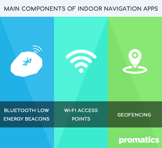
Besides an indoor navigation system, the indoor navigation app also needs specific hardware to function. There are three types of hardware which are mentioned in the list below. The best strategy is mixing different types of hardware to achieve location accuracy. Here is the list.
Bluetooth Low Energy Beacons – BLE Beacons are known to have 2-3 meter accuracy range and have a long battery life. They are supported by both; Android and iOS smartphone platforms. The BLE Navigation solutions are capable of calculating the route on the server that reduces the load on the device. For the BLE Beacons navigation system to work accurately, the user must be in the range of at least three BLE Beacons for successful route mapping. This is called triangulation method.
Wi-Fi Access Points- The Wi-Fi access points work as signal transmitters and they do not play any role in determining the user’s position. The smartphone picks the signals from Wi-Fi access points and calculates the user’s position.
Geofencing – Geofencing uses geomagnetic map of the venue and smartphone’s in built compass. However, the magnetic field needs to be stable for location accuracy. Also, with every new geomagnetic source, the geomagnetic map needs to be updated by source.
Thus, you can see different navigation technologies work together to determine the user’s location in real-time and guide him/her towards the destination using the shortest route.
Features of Indoor navigation apps
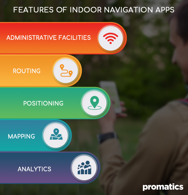
Indoor navigation apps are different from regular GPS navigation apps. Here is the list of mandatory features that need to be part of indoor navigation apps.
- Positioning – the app determine user’s location using different positioning system
- Mapping- the app shows different possible routes and all locations
- Routing – the app determines the best route to reach a specific destination and guides the user to reach the destination
- Analytics – the app shows the number of visitors to the facility
- Administrative facilities – the app allows the building manager to maintain navigation systems tools like beacons, Wi-Fi access points and also allows to set promotional campaigns
Depending on your business and facility navigation requirements, you can include optional features like
- Login using your Facebook ID
- Voice guidance
- Custom design
- 3D map visualization
- Find-a-friend
How can businesses benefit from indoor navigation apps?
The indoor navigation apps make these things possible
- Collect visitor data such number of visits, amount of time spent in a specific location, and favorite places
- Send notifications
- Create trigger-based events such as showing a discount when the visitor heads towards a specific destination or when the user passes by the store.
Costs of building an Indoor navigation app
The cost of building an indoor navigation app depends on the customization and different features you want to include. According to app development companies, the cost of building a basic indoor navigation app is in the range of $10,000 to $50,000. The cost of optional features is in the range of $20,000 to $50,000. The above-mentioned costs are only related to software development. There are other costs involved that include hardware, other electronic components required to create an electronic map of the facility.
Hardware costs – a three-piece kit of Bluetooth Low Energy Beacons is in the range of $20 to $60 each. The price of Geofencing varies with service providers.
After you create an indoor navigation app, you need to update it periodically and also pay for some of the services required for indoor navigation apps to operate effectively. Some of them are
Servers
Businesses which own indoor navigations apps need to invest in servers to store mapping information. This will help in saving time especially when BLE beacons battery dies and need to be replaced. Businesses also need separate servers to store information about marketing campaigns and for sending push notifications to user’s smartphone.
3rd party services
Businesses also need to pay for PaaS (Platform as a Service) solutions required for storage and also for location engine service provider. This will help in cutting time and expenses in maintenance.
Device Updates/Upgrades
Businesses need to update indoor navigation map when the user updates or upgrades his/her device. The app will also require updating when the BLE beacons are changed.
Indoor Navigation apps for guidance and user data
An indoor navigation app not only helps businesses serve customers in the best way possible, it also helps them in collecting analytical data that can be useful to study visitor/consumer behavior. You can build indoor navigation apps based on different technologies depending on requirements of your business and the type of facility. You can always change to different technology when the need arises.
Wrapping up
If you are looking to help people find their way in your big business complex, the indoor navigation app is the solution that can help you achieve that easily. Not to mention, it can also send you exciting offers to user’s smartphone that can increase footfalls in your store and help generate more revenue.

